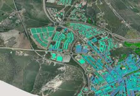
GIS which is sometimes referred to as the Geospatial Information System and other times as Geographical Information system is a series of systems and apps connected to each other, designed to capture, store, manipulate and analyze spatial or geo-spatial data.
Traditionally GIS was run on the computer system where people capture, store, analyze information pertaining to land. The concept of GIS and its applications were first used by Canadian expert Roger Tomlinson during the 1960s when he used it to collect, store and analyze data about Canada’s land-use patterns. After this during the decades of the 1970’s and 1980s several national agencies of many countries started using GIS information for various land use purposes. It was during this phase that GIS technology started to evolve rapidly, improving the quality and usability of technologies. Throughout the 1990s software companies started making various desktop applications for the purpose of doing GIS research. ArcGIS, MapInfo, ArcView, GeoViewer among many other software applications were created for the public, government agencies to extract information about land-use patterns. Businesses also started to use GIS information to know about the usability of land and also to know the distribution of not only their customers but also suppliers of resources and raw materials.
The various Applications of GIS:
GIS uses many types of data to reveal insights and patterns that help people and organizations in everything, from urban planning, environmental conservation, and disaster response to healthcare and even marketing. At present, the GIS market is valued to be around 10 Billion USD and is expected to rise around 18 Billion by 2023.
GIS and its applications span nearly in all conceivable fields. This growth is mainly due to investments in homeland security by both developed and developing nations, and also immense capital funding in urban development.
Urban Planning: At present times, urban planning accompanied by the use of GIS has immense applications. A GIS helps surveyors, engineers, and urban architects to not only design, map and expand the cities wherever possible but it also helps to determine illegal encroachment of land, detect urban areas vulnerable to disaster among many other such applications. The “smart cities” also heavily rely on GIS data for the purpose of the development of infrastructure and services.
Disaster Response: GIS applications are proving to be a lifesaver when it comes to detecting and predicting natural calamities such as – cyclones, Droughts, and flash floods. Geospatial intelligence provides experts, governments and rescue teams important data regarding any disaster, be it natural or man-made. After the disaster has struck, GIS application helps in detecting the area’s most severely affected by the disaster.
Defense and Military applications: Applications of GIS technology in the domain of defense and security include surveillance of allied territories, surveillance of enemy encampments, military operations and also to gather intelligence information to better prepare for military applications.
Environmental Conservation: GIS technology has advanced to such an extent that all the different species of trees in a forest can be represented using a GIS mapping system.GIS technologies enable scientists and environmentalists to make better decisions about the conservation of flora and fauna by preparing conservation management strategies. Scientists can measure biodiversity distribution with the use of GIS; this particularly is useful in identifying endangered species.
Business analytics: Logistical issues such as transportation, route planning, navigation and supply chain management can be easily solved with the help of GIS applications. GIS can help business access risk as well as make more informed management plans.
The future of GIS is very promising indeed. It is gearing up for even greater applications than we have seen in previous decades. One of the biggest changes in the future of GIS will come at the user interface level (UI). GIS in the future will very much find its way into virtual and augmented reality which will lead to more developers integrating GIS capabilities into their application. In the future, 3D and mobile GIS are more likely to merge, mobile GIS applications will create immense experiences and early examples of which can be seen in the Pokémon Go game. The stage has been already set for even wider applications of GIS in the future.
